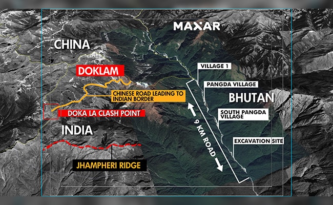
New satellite images accessed by NDTV indicate that a Chinese village, constructed 9 km East of the Doklam plateau where Indian and Chinese forces faced off in 2017, is now fully inhabited with cars parked at the doorstep of virtually every home.
Significantly, the village, which Beijing calls Pangda, lies squarely within Bhutanese territory, details of which were first reported by NDTV in 2021.
Alongside Pangda is a neatly marked all-weather carriageway, part of China’s extensive land-grab in Bhutan. This cuts 10 km into Bhutanese territory, along the banks of the fast-flowing Amo Chu river.
For India, construction along the Amo Chu means that Chinese forces could end up getting access to a strategic ridge in the adjacent Doklam plateau. This would give them a direct line-of-sight to India’s sensitive Siliguri corridor, the narrow sliver of land that connects the northeast states with the rest of the country. NDTV